Use case: fall protection
Fall protection monitoring from construction cameras
Fall hazards are one of the highest-severity risks on a jobsite. OSHA Compliance AI turns routine camera footage into a daily review workflow, helping teams spot work-at-height exposure and missing protection evidence earlier.
What the system flags
Work-at-height scenes, fall-risk zones, and conditions that suggest missing personal or collective fall protection. Findings are structured for review and correction, not for automatic enforcement.
What you receive
Marked clips, finding rows with evidence links, and recommendations that translate directly into a corrective-action plan.
How teams use it
Use evidence to tighten pre-task planning, validate guardrail/edge protection, and ensure fall-protection workflows stay consistent across crews.
Highlights
- Work-at-height incident clips and evidence links
- Findings structured for supervisor review
- Recommendations for corrective action and follow-up
- Designed for private preventive workflows
Marked clips
Processed examples using existing evidence assets. Each clip is designed to be reviewable and actionable for supervisors.
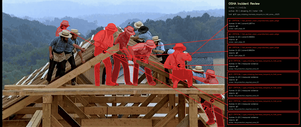
A processed clip where fall-risk work is visible without sufficient protection evidence.
Open marked clip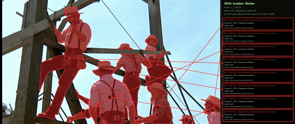
A short clip where fall-risk context and PPE evidence gaps combine into a higher-severity review item.
Open marked clipEvidence cards
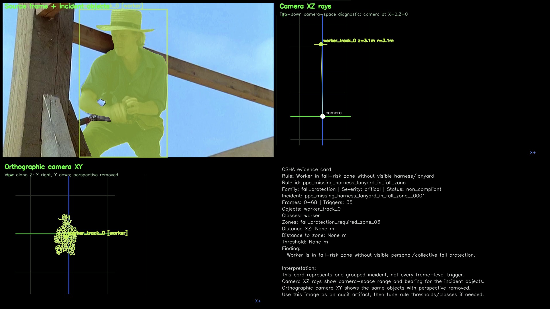
Evidence cards make incidents easy to route, correct, and revisit during follow-up.
FAQ
Is this a replacement for fall-protection training?
No. It is a visibility and follow-up tool that helps confirm whether fall-protection expectations are being met in the field.
Do you need zone configuration?
Zones improve accuracy, but teams can start with basic detection and strengthen results as site zones are mapped.